Carte IGN 3715O
Un article de Wiki Chouette d'Airyn, l'encyclopédie libre.
| Version du 26 avr 2021 à 13:28 Airyn2 (Discuter | contribs) Points d'intérêt ← Go to previous diff |
Version du 26 avr 2021 à 13:44 Airyn2 (Discuter | contribs) Points d'intérêt Go to next diff → |
||
| Ligne 227: | Ligne 227: | ||
| | 2.3 km | | 2.3 km | ||
| | Rocher | | Rocher | ||
| - | | Piton de grès isolé (non loin d'un autre bloc massif), altitude 530 m, [http://www.t4t35.fr/Megalithes/AfficheSite.aspx?Projet=France&IDSite=STRO02-0 Fiche du site T4T35], [http://www.reinhardsmunster.fr/index.php?page=le-rocher-du-hibou photos 1], [http://ignrando.fr/fr/pointsinteret/fiche/details/id/255285 photos 2]. | + | | Piton de grès isolé (non loin d'un autre bloc massif), altitude 530 m, [http://www.t4t35.fr/Megalithes/AfficheSite.aspx?Projet=France&IDSite=STRO02-0 Fiche du site T4T35], [http://www.reinhardsmunster.fr/index.php?page=le-rocher-du-hibou photos 1], [http://ignrando.fr/fr/pointsinteret/fiche/details/id/255285 photos 2], [http://www.cirkwi.com/fr/point-interet/1351763-rocher-du-hibou photo du rocher] sur cirkwi.com. |
| |- | |- | ||
| ! bgcolor="#ccff99" align="left" | Kelchfels | ! bgcolor="#ccff99" align="left" | Kelchfels | ||
| Ligne 249: | Ligne 249: | ||
| | Stèle | | Stèle | ||
| | non loin au nord du Rocher des Pandours | | non loin au nord du Rocher des Pandours | ||
| + | |- | ||
| + | ! align="left" | Fontaine Jean-Louis [http://fr.wikipedia.org/wiki/Haemmerlin Haemmerlin] | ||
| + | | 48.703055 | ||
| + | | 7.309783 | ||
| + | | 2.3 km | ||
| + | | fontaine | ||
| + | | O de Thal-Marmoutier, [http://www.cirkwi.com/fr/point-interet/1351741-fontaine-jean-louis-haemmerlin photo de la fontaine] sur cirkwi.com. | ||
| |- | |- | ||
| ! bgcolor="#ccff99" align="left" | Rocher des Pandours | ! bgcolor="#ccff99" align="left" | Rocher des Pandours | ||
| Ligne 340: | Ligne 347: | ||
| | rocher | | rocher | ||
| | - | | - | ||
| + | |- | ||
| + | ! align="left" | Fontaine Adactem | ||
| + | | 48.660987 | ||
| + | | 7.248351 | ||
| + | | 4.3 km | ||
| + | | fontaine | ||
| + | | NE de Dabo, [http://www.cirkwi.com/fr/point-interet/1244432-fontaine-adactem photo de la fontaine] sur cirkwi.com. | ||
| |- | |- | ||
| ! bgcolor="#ccffff" align="left" | Gewinnwald | ! bgcolor="#ccffff" align="left" | Gewinnwald | ||
| Ligne 424: | Ligne 438: | ||
| | maison forestière | | maison forestière | ||
| | E de Danne-et-Quatre-Vents, [http://www.cirkwi.com/fr/point-interet/1349081-kaltwiller-maison-forestiere photo de la maison] sur cirkwi.com. | | E de Danne-et-Quatre-Vents, [http://www.cirkwi.com/fr/point-interet/1349081-kaltwiller-maison-forestiere photo de la maison] sur cirkwi.com. | ||
| + | |- | ||
| + | ! align="left" | Chapelle Sainte-Barbe. | ||
| + | | 48.75837 | ||
| + | | 7.345967 | ||
| + | | 8.8 km | ||
| + | | chapelle | ||
| + | | N d'Ottersthal, [http://www.cirkwi.com/fr/point-interet/1349091-la-chapelle-sainte-barbe photo de la chapelle] sur cirkwi.com. | ||
| |} | |} | ||
Version du 26 avr 2021 à 13:44
La carte IGN 3715O est la carte "série bleue" à l'échelle 1:25000 (1 cm sur la carte = 250 m sur le terrain) de la région de Dabo et sur laquelle figure la Borne Saint Martin.

La carte couvre une surface de 13.24 km (en longitude) par 20.02 km (en latitude), soit 265.065 km² (soit 26 506.5 hectares). Les coordonnées de la carte sont : 7°E 11'52" - 7°E 22'40" / 48°N 46' 51" - 48°N 36'3" (soit en degrés décimaux 7.1977778 E - 7.3777778 E / 48.780833 N - 48.600833 N). La projection utilisée pour dessiner la carte est une projection conique conforme de Lambert (rappelons que la projection sert à figurer sur un dessin en deux-dimensions un territoire courbe dans les trois dimensions).
La carte existe en 2 versions :
- 3715 O, "série bleue" : les cartes de la "série bleue" sont agencées en "ouest" (O) et "est" (E) car elles résultent du découpage de la "série orange". Elles sont quasi-rectangulaires car elles résultent d'un découpage géographique de la France en "rectangles" de 0.2 grades par 0.2 grades.
- 3715 OT, "TOP 25": les cartes "TOP 25" sont adaptées à la randonnée (et établies avec l'aide du Club Vosgien), elles couvrent un territoire non rectangulaire plus grand (http://www.visorando.com/carte-ign-3715ot.html) que la "série bleue" du même nom.
Il existe aussi des cartes éditées par le "Club Vosgien".
Emprises de la carte "3715 OT", et liste des localités (http://www.monbeauvillage.fr/carte-ign/3715OT) :
- sur Skitour (http://www.skitour.fr/cartes/detail-carte.php?c=3715OT).
- sur Visorando (http://www.visorando.com/carte-ign-3715ot.html).
| Sommaire |
Editions de la carte
Séries "bleue" et "TOP 25"
| Nom de la carte | N°édition, année | EAN / ISBN / autre | Commentaires |
|---|---|---|---|
| 3715O | 1908 | -- | |
| 3715O | 1939 | -- | Deux feuilles : 3715(1-2), 3715(5-6). |
| 3715O "série bleue" | 1e éd., 1956 | -- | Deux feuilles : 3715(1-2), 3715(5-6). "Levés allemands de 1883. révisés en 1956." |
| 3715O "série bleue" | 2e éd., 1976 | -- | Un seul quart de feuille : uniquement le haut de la carte (1-2), car le bas (5-6) n’existe pas. |
| 3715O "série bleue" | 3e éd., 1981 | (FRBNF40787264 (http://catalogue.bnf.fr/ark:/12148/cb40787264t)) | Relevés sur le terrain : 1979. Nord magnétique : 2°37'. Cette édition ne possède pas de n°ISBN. |
| 3715O "série bleue" | 4e éd., 1988 | 3282111371560 ; (FRBNF40788079 (http://catalogue.bnf.fr/ark:/12148/cb40788079j)) | Relevés sur le terrain : 1986. Nord magnétique : 1°24'. La face et le revers de la couverture de la carte sont identiques, sauf le code barre de l'ISBN qui apparaît à côté de "SERIE BLEUE". Lorsque la carte est pliée, l'indication "3715 ouest ● saverne" apparaît sur la tranche. |
| 3715OT "TOP 25" | 1e éd., 1993 | 3282113715010, (FRBNF40858184 (http://catalogue.bnf.fr/ark:/12148/cb40858184z)) | Relevés sur le terrain : 1991. Nord magnétique : 0°56'. Remarque : cette carte est parue en 1993, l'année du lancement de la chasse ; le mois de parution est crucial car si elle est parue avant avril 1993, elle peut pas être utile pour le jeu. Selon jeanps, elle est parue en août 1993 (Source : message n°3017 sur Edelweb). Selon harold, elle date de septembre 1993 (Source : message n°71993.010101 sur lachouette.net). Selon ppalo, en 1993 le catalogue IGN ne présentait pas de cartes TOP 25 dans les Vosges (Source : message n°53052.04 sur lachouette.net). |
| 3715OT "TOP 25" | 2e éd., 1998 | 3282113715027 | Cette carte étant parue bien après le lancement de la chasse (en avril 1993), elle ne peut pas être "utile". |
| 3715OT "TOP 25" | 3e éd., 2006 | 978-2-7585-0329-3 | -- |
| 3715OT "TOP 25" | 2007 | 2758503298 | Le service internet geoportail ayant été lancé en 23 juin 2006, on peut supposer qu'il n'y a plus de numéro d'édition. |
| 3715OT "TOP 25" | 2020 | 9782758550464 | -- |
Séries "orange" et autre
| Nom de la carte | N°édition, année | EAN / ISBN / autre | Commentaires |
|---|---|---|---|
| Saverne, Etat-major de l'armée de terre (Service historique de l'armée de terre) | 1867? | (491880949 (http://www.worldcat.org/title/saverne-54/oclc/491880949&referer=brief_results)) | "les travaux sur le terrain ont été exécutés par MMrs Levret, Constantin, Reverdit... [et al.] ; levée par les Officiers du Corps d'Etat-Major ; et publiée par le Dépôt de la Guerre en 1837" |
| Carte de France au 50 000e (Type 1922), Flle XXXVII-15, Saverne | 1922 | (FRBNF40795799 (http://www.worldcat.org/title/carte-de-france-au-50-000e-type-1922-flle-xxxvii-15-saverne/oclc/492547483&referer=brief_results)) | Éditeur: Paris : Service géographique de l'armée, 1926. |
| 3715, échelle 1:50 000 | 4e éd., 1982 | (FRBNF40795799 (http://catalogue.bnf.fr/ark:/12148/cb40795799k)) | |
| 3715, échelle 1:50 000 | 5e éd., 1989 | (FRBNF40796742 (http://catalogue.bnf.fr/ark:/12148/cb40796742v)) | -- |
| Série orange 1:50 000, 3715, Saverne | 6e éd., 1996 | (3A493623589 (http://www.worldcat.org/search?q=no%3A493623589)) | -- |
| Série M 761, 1989, 1:50 000 | 7e éd., 1989 | (FRBNF40870170 (http://catalogue.bnf.fr/ark:/12148/cb40870170r)) | -- |
Points d'intérêt
| Nom du lieu | latitude | longitude | Distance au centre de la carte | Catégorie | Commentaires |
|---|---|---|---|---|---|
| Abri Neubaufelsen | 48.687906 | 7.282617 | 380 m | Abri ou gloriette | altitude 516 m, photo de l'abri (http://www.refuges.info/photos_points/13905.jpeg?1314375307) |
| Gibraltar | 48 | 7 | 980 m | Rocher | - |
| Seebfels | 48.683186 | 7.285185 | 750 m | Rocher | altitude 511 m. une passerelle relie les 2 rochers de la Seeb. |
| Ochsenstein (Chât.Rné) | 48 | 7 | 1.24 km | Château | - |
| Pierre des Druides | 48 | 7 | 1.54 km | Rocher | Fiche du site T4T35 (http://www.t4t35.fr/Megalithes/AfficheSite.aspx?Projet=France&IDSite=DRDRUI-4). |
| Haberacker | 48 | 7 | 1.56 km | Maison Forestière | photo (http://img.over-blog.com/500x375/4/99/26/33/OCHSENSTEIN/ochsenstein0050.jpg) |
| Baerenbach | 48 | 7 | 1.61 km | Maison Forestière | - |
| Schoenfels | 48 | 7 | 1.77 km | rocher | paroi rocheuse, et à proximité un "rocher-champignon" |
| Ecole d'Escalade | 48 | 7 | 1.9 km | ? | - |
| Rocher de la Spille | 48 | 7 | 1.96 km | Rocher | Monolithe rocheux haut de 9 mètres. Lien (http://www.reinhardsmunster.fr/index.php?page=le-spillberg). Fiche du site T4T35 (http://www.t4t35.fr/Megalithes/AfficheSite.aspx?NumSite=12111), informations et photos (http://www.vosges-rando.net/eng/Res/En339.htm). |
| Grotte des Francs-Tireurs | 48 | 7 | 2.0 km | Grotte | - |
| Rocher Marguerite | 48 | 7 | 2.2 km | Rocher | appelé aussi Marguarietenfels. |
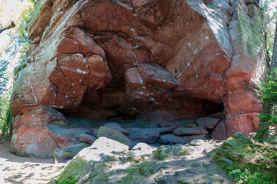
| Rocher du Hibou | 48.689409 | 77.31738 | 2.3 km | Rocher | Piton de grès isolé (non loin d'un autre bloc massif), altitude 530 m, Fiche du site T4T35 (http://www.t4t35.fr/Megalithes/AfficheSite.aspx?Projet=France&IDSite=STRO02-0), photos 1 (http://www.reinhardsmunster.fr/index.php?page=le-rocher-du-hibou), photos 2 (http://ignrando.fr/fr/pointsinteret/fiche/details/id/255285), photo du rocher (http://www.cirkwi.com/fr/point-interet/1351763-rocher-du-hibou) sur cirkwi.com. |
| Kelchfels | 48.683666 | 7.256515 | 2.3 km | Rocher | rocher en forme de calice ou de champignon. |
| Abri du Geissfelswasen | 48 | 7 | 2.3 km | Abri, gloriette | altitude 510 m |
| Stèle | 48 | 7 | 2.3 km | Stèle | non loin au nord du Rocher des Pandours |
| Fontaine Jean-Louis Haemmerlin (http://fr.wikipedia.org/wiki/Haemmerlin) | 48.703055 | 7.309783 | 2.3 km | fontaine | O de Thal-Marmoutier, photo de la fontaine (http://www.cirkwi.com/fr/point-interet/1351741-fontaine-jean-louis-haemmerlin) sur cirkwi.com. |
| Rocher des Pandours | 48 | 7 | 2.44 km | Rocher | - |
| Kempel | 48 | 7 | 2.44 km | Maison Forestière | - |
| Vestiges Gallo-romains du Wasserwald | 48 | 7 | 2.7 km | Vestiges Gallo-romains | Fiche du site T4T35 (http://www.t4t35.fr/Megalithes/AfficheSite.aspx?Projet=France&IDSite=ROGAL5+4). |
| Maisonnette de Pierres | 48 | 7 | 2.76 km | Maison ruinée | - |
| Borne St-Martin | 48 | 7 | 2.98 km | pierres dressées / borne frontière | Fiche du site T4T35 (http://www.t4t35.fr/Megalithes/AfficheSite.aspx?Projet=France&IDSite=MSSAI2-2). |
| Châlet du Limmersberg | 48 | 7 | 3.03 km | châlet | commune d'Hultehouse |
| Table des Géants | 48 | 7 | 3.04 km | rocher | Fiche du site T4T35 (http://www.t4t35.fr/Megalithes/AfficheSite.aspx?Projet=France&IDSite=DRTAB2-4). |
| Rocher Lorenzo | 48 | 7 | 3.1 km | rocher | multiples blocs |
| Grotte du Brotsch | 48 | 7 | 3.23 km | grotte | photo (http://www.alain-collet.com/Vosges/GTVO/Photo_big/060.jpg) |
| Tour du Brotsch | 48 | 7 | 3.44 km | tour | Fiche du site T4T35 (http://www.t4t35.fr/Megalithes/AfficheSite.aspx?Projet=France&IDSite=FOTOUR-0). |
| Satterfels | 48 | 7 | 3.6 km | borne-menhir | appelé Sattelfels sur géoportail, borne frontière qui sépare les départements de la Moselle et du Bas Rhin. Fiche du site T4T35 (http://www.t4t35.fr/Megalithes/AfficheSite.aspx?Projet=France&IDSite=MHSATT-4). |
| La chapelle St-Fridolin | 48.69148 | 7.237592 | 3.6 km | chapelle | voir cette page (http://ilotresor.com/photo-360-de-la-chapelle-saint-fridolin/) du site de Mickey. |
| Rocher du Muguet | 48 | 7 | 3.85 km | rocher | - |
| Fontaine Adactem | 48.660987 | 7.248351 | 4.3 km | fontaine | NE de Dabo, photo de la fontaine (http://www.cirkwi.com/fr/point-interet/1244432-fontaine-adactem) sur cirkwi.com. |
| Gewinnwald | 48 | 7 | 4.3 km | Maison Forestière | - |
| Col du Valsberg | 48 | 7 | 4.33 km | col | deux bornes en pierre |
| Sickertkopf | 48.666766 | 7.236452 | 4.4 km | barre rocheuse | aussi appelé Sickertkopffels, superbe point de vue, un banc sur la plateforme sommitale. |
| Rocher du Petit Moulin | 48.735016 | 7.264041 | 5.3 km | rocher | barre rocheuse possédant une série d'escaliers métalliques, photos 1 (http://www.randoalsacevosges.com/article-rocher-du-petit-moulin-et-chateau-de-lutzelbourg-120960222.html), photos 2 (http://nos-randonnee-lamas.over-blog.com/2015/12/sentier-des-roches-de-lutzelbourg.html). |
| Rocher du Corbeau | 48.7376 | 7.255729 | 5.8 km | rocher | Krappenfeld ou Krappenfels, photos (http://www.tourisme-lorraine.fr/a-voir-a-faire/visites/sites-naturels/847000528-rocher-du-corbeau-lutzelbourg-lutzelbourg). Superbe lion taillé (http://mes-photos-57400.over-blog.com/article-le-lion-du-krappenfels-78982850.html) dans le grès et prêt à bondir. |
| Croix du Loup | 48.64124 | 7.245205 | 6.2 km | croix | nommée aussi "Wolfsgrubkreutz", voir cette page (http://ilotresor.com/photo-360-de-la-croix-du-loup/) du site de Mickey. |
| La Gloriette du Koepfel | 48.743044 | 7.338113 | 7.05 km | abri, gloriette | O de Saverne, photo du rocher (http://www.cirkwi.com/fr/point-interet/1349073-la-gloriette-du-koepfel) sur cirkwi.com. |
| Croix du Rosskopf | 48.625907 | 7.256058 | 7.45 km | croix | "dite croix du Hengster Sepp", et grotte des Commandants des Armes et Des Services ; voir cette page (http://ilotresor.com/photos-360-croix-du-rosskopf-et-grotte-des-cads/) du site de Mickey. |
| Stèle d'Edmond About | 48.746359 | 7.342928 | 7.5 km | stèle | O de Saverne, altitude 215 m, photo de la stèle (http://www.cirkwi.com/fr/point-interet/1349063-la-stele-edmond-about) sur cirkwi.com. Il est marqué sur la stèle : "En souvenir / d'Edmond About / de l'Académie Française / -1853-1865- / ``Pendant douze ou treize ans / Mes travaux mes plaisirs / Mes affections toute ma vie morale / A gravité autour de Saverne / Edmond About.``". |
| Rocher du Saut du Prince Charles | 48.749129 | 7.34025 | 7.6 km | rocher | Il doit son nom au duc Charles de Lorraine. photo du rocher (http://www.cirkwi.com/fr/point-interet/1349065-rocher-du-saut-du-prince-charles) sur cirkwi.com. |
| Steinerne Maennel | 48.619899 | 7.263132 | 8.0 km | rocher | signifie "bonhomme de pierre", rocher de forme remarquable. |
| Kaltwiller, maison forestière. | 48.765166 | 7.318895 | 8.7 km | maison forestière | E de Danne-et-Quatre-Vents, photo de la maison (http://www.cirkwi.com/fr/point-interet/1349081-kaltwiller-maison-forestiere) sur cirkwi.com. |
| Chapelle Sainte-Barbe. | 48.75837 | 7.345967 | 8.8 km | chapelle | N d'Ottersthal, photo de la chapelle (http://www.cirkwi.com/fr/point-interet/1349091-la-chapelle-sainte-barbe) sur cirkwi.com. |
Liens
Voir aussi :
- Dabo
- Ressources cartographiques
- Grille IGN et télécharger toute la grille (http://airyn.free.fr/Airyn_grilleIGN.kml) au format kml (Airyn).
- étude détaillée de la carte de Dabo (http://lachouette.net/contrib/Airyn/La_carte_de_Dabo_Airyn.pdf) (document pdf), par Airyn (juillet 2020).
- Toponymes des hauteurs vosgiennes (http://www.dna.fr/edition-de-saverne/2019/03/26/toponymes-des-hauteurs-vosgiennes), par Daniel Peter (2019) dans les Dernières Nouvelles d'Alsace.
Mini-cartes IGN
- Image gif (http://airyn.free.fr/cartes_IGN/3715O.gif) de la carte.
- liste des POIs (http://airyn.free.fr/cartes_IGN/3715O_liste_POIs.dat) (points of interest) figurant sur la carte.
